
Pier seabed monitoring
The September 21 earthquake occurred in 1999, and there was a serious subsidence of the 2-4 wharf of Taichung Port. Onshore docks and facilities can be repaired actively and quickly, but the port channel is often a blind spot for monitoring between the dock wall and the seabed contact surface. However, due to the influence of visibility, it is impossible to obtain comprehensive qualitative and quantitative results by video (diving personnel or ROV) or side-scan sonar system between the seabed and the dock surface. Therefore, it is also the best way to measure this area with a multibeam sounding system. Our team also used the multibeam sounding system to measure the junction of the channel and the wharf surface of Taichung Port No. 2-4 Wharf (as the picture shows). the change between the terrain structure and the vertical plane of the wharf can be clearly seen.
Most of the water depths of Taiwan's existing port channels do not exceed 20 meters, so the shallow water multibeam sounding system is used to measure. The resolution of its terrain and features should be maintained below 0.5 meters. For the monitoring of high-resolution terrain (such as the terrain of the main channel or turning circle), ground objects (such as the caisson-type wharf surface or the fixed piles under the trestle-type wharf), etc.
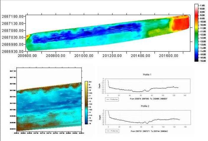
The image map of the waterway of Taichung Port Pier 2-4 measured by the multibeam sounding system(Top) Partial enlarged image and cross-sectional view (bottom)